Wildlife crossings are often discussed after a collision, a field observation, or a proposed construction project. North Idaho Wildlife Bottlenecks asks whether public data can be combined earlier to identify places that deserve closer ecological and transportation attention.
The project takes the form of a Python and GIS workflow that combines public geography, transportation, habitat, and incident evidence to rank candidate wildlife bottlenecks in North Idaho. Its purpose is to help focus local research and mitigation attention without presenting modeled candidates as proven ecological corridors.
The question behind North Idaho Wildlife Bottlenecks
The analysis avoids treating one score as a discovered truth. Mortality evidence, road safety, economic cost, landscape connectivity, and source quality describe different questions; preserving those dimensions makes it easier to see why a location appears important and what evidence is still missing. Transportation planners, conservation groups, researchers, residents, and wildlife may benefit. Landowners and agencies are affected when locations are characterized, so claims require careful sourcing.
How North Idaho Wildlife Bottlenecks took shape
A reproducible Python and geospatial pipeline collects public layers, transforms them into comparable spatial evidence, and produces ranked candidate areas with source history. The output is a research screen that can guide field work, not a substitute for animal-movement data or agency review. I framed the local problem, evidence categories, interpretive limits, and publication boundary while directing agent-assisted research and implementation.
Analysis output · candidate screen
The maps narrow the field without pretending to prove a corridor.
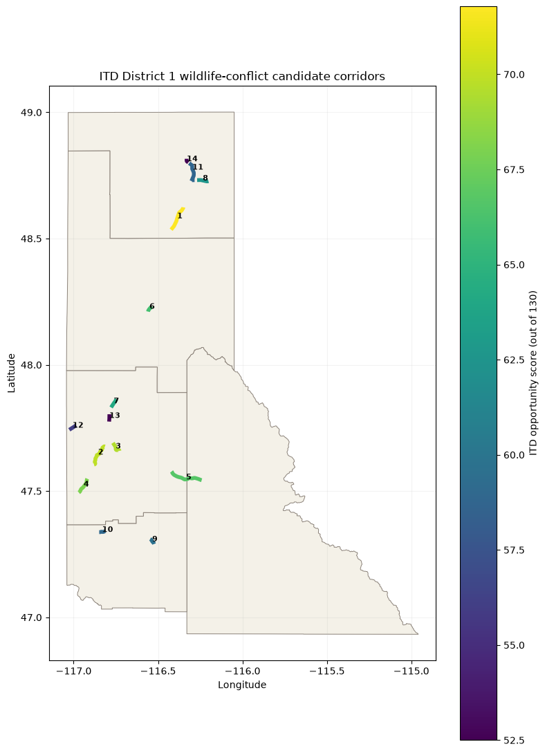 Candidate corridors
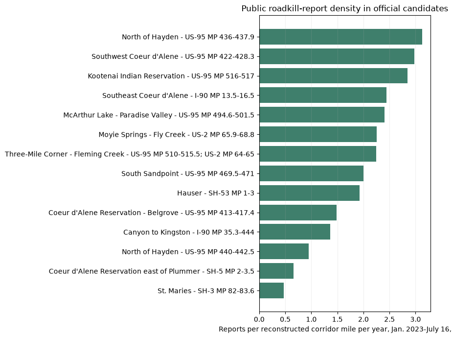 Public report density
These are research-screening outputs from public transportation and roadkill evidence. They rank candidates for closer ecological review; they are not animal-movement findings or final mitigation priorities.
Source: Reproducible project notebook · July 2026What the evidence supports
The working analysis produces source-linked candidate locations and preserves the inputs and reasoning used to rank them. The project demonstrates a useful role for transparent modeling in local conservation: narrowing an enormous landscape into a defensible set of next questions. Its honesty depends on calling those locations candidates until independent ecological evidence confirms more.
The outputs are screening hypotheses, not proof of animal movement or project feasibility. Field validation, current agency data, and ecological review remain necessary. A future public edition would pair the data methodology and candidate atlas with explicit uncertainty labels before inviting domain review.