Water towers are among the most visible pieces of civic infrastructure and among the least legible to the people who pass them. Their operators, histories, projects, and service relationships are scattered across public documents and local knowledge.
The project takes the form of an evidence-backed map and data model for water towers, standpipes, operators, public sources, photos, projects, claims, and conservatively described service areas. Its purpose is to make local infrastructure discoverable and historically legible without exposing sensitive operational details.
Working atlas · verified field record
A public landmark stays connected to the evidence behind it.
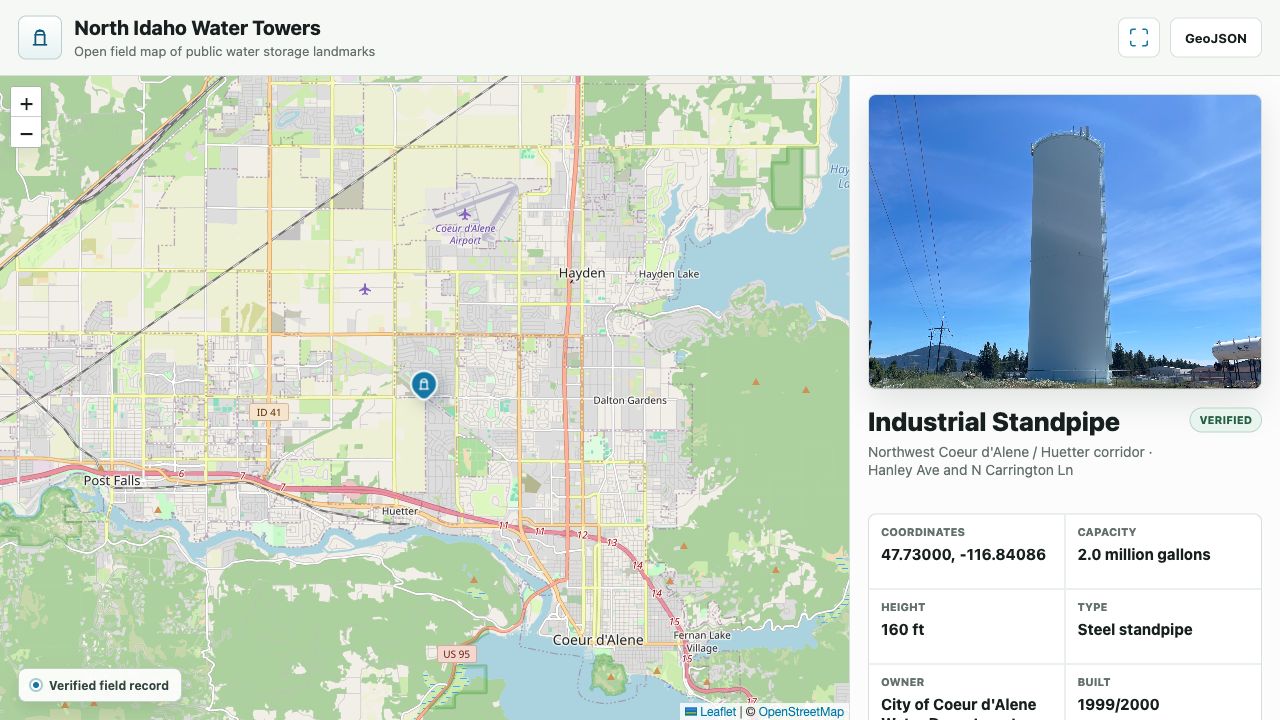
The working atlas joins a mapped structure to a field photograph, verification state, public-source attributes, and conservative infrastructure context.
Source: Current OpenWaterTowers interface · July 2026The question behind OpenWaterTowers
OpenWaterTowers turns that scattered material into an evidence-backed atlas. It distinguishes verified structures from candidates and links locations to operators, public sources, photographs, claims, projects, and conservatively described service context. Residents, local historians, civic researchers, infrastructure enthusiasts, and contributors performing safe verification from public viewpoints.
How OpenWaterTowers took shape
The repository uses structured records, GeoJSON layers, research logs, source links, and field-verification guidance. The contribution workflow is intentionally cautious: contributors can document a public landmark without collecting access details or other operational information that would add risk without adding civic value. I established the civic purpose, public-interest questions, data model, verification workflow, and safety boundary, working with coding agents to implement the repository.
What the evidence supports
The public repository includes verified records, candidate layers, source-linked research, mapping, a contribution workflow, and explicit code and data licenses. The broader idea is that open infrastructure data can be both useful and restrained. Good documentation does not require publishing every discoverable detail; it requires choosing the details that improve public understanding and preserving the evidence behind them.
Coverage is still local and incomplete. The project avoids access details, security signage, restricted utility maps, and sensitive operational information. The next edition will add a concise results summary, richer project media, and a broader set of verified records.